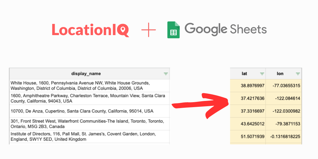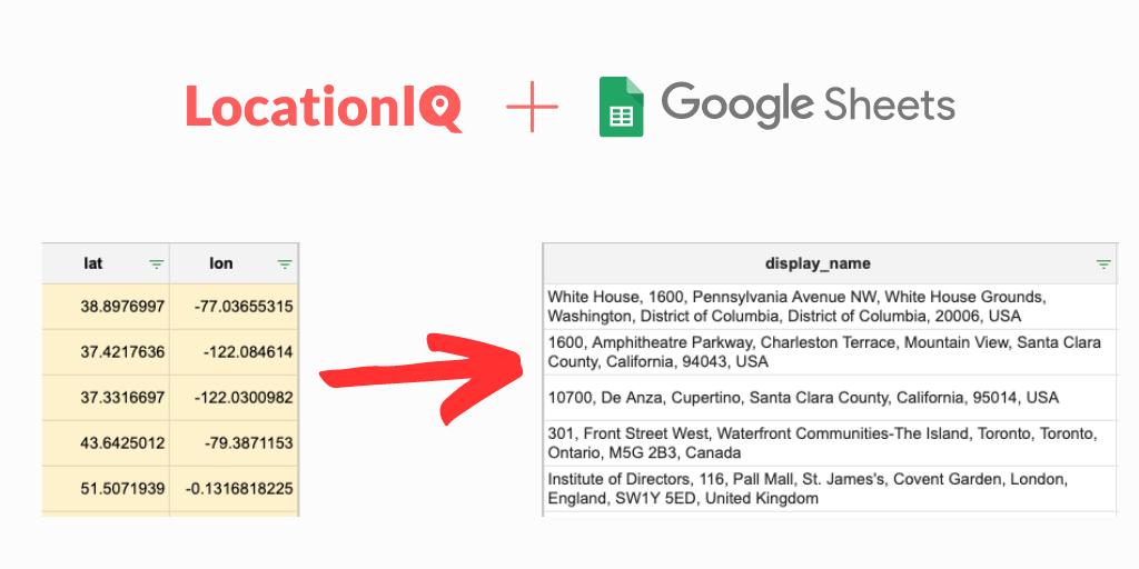
Reverse geocoding takes latitude and longitude points, obtained by GPS devices, and returns associated street addresses and place names. This is useful if you want to plot GPS data on a map and show the address. In this tutorial, we’ll be covering how to use reverse geocoding with Python with an example from LocationIQ
Step 1: Signup for an account with LocationIQ
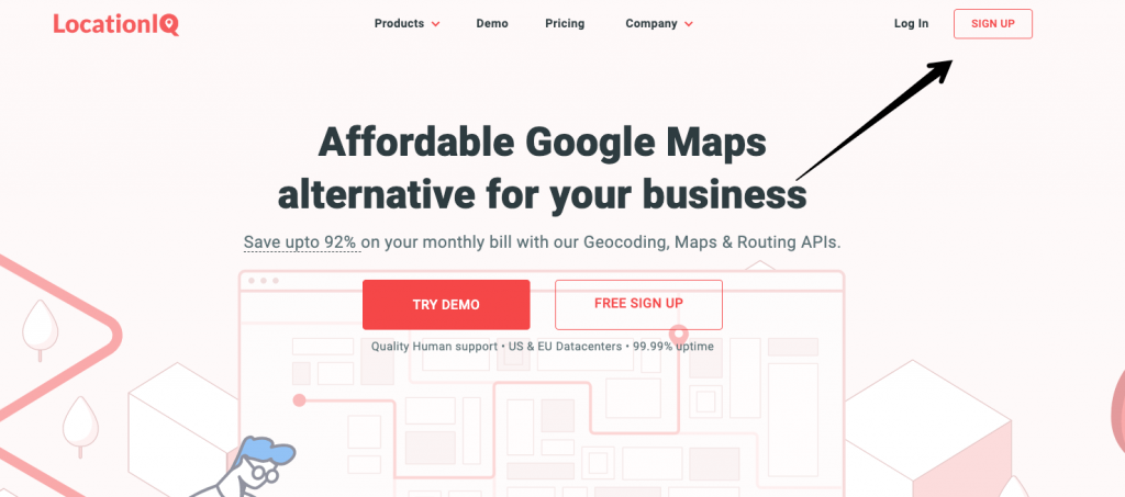
- Go to the LocationIQ website (https://locationiq.com/) and click on the “Sign Up” button in the top right corner of the page.
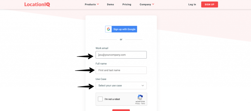
- Fill out the registration form and click on the “Sign Up” button to create your account.
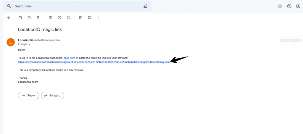
- You will receive an email with login URL. Your account will be created when you click this.
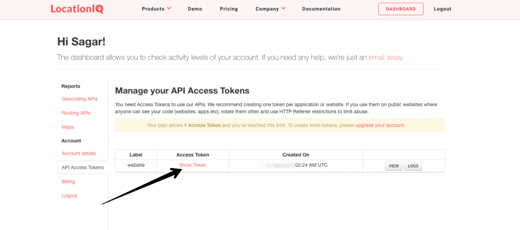
- Once your account is created, log in to the dashboard.
- Your API Access Token will be displayed on the dashboard. Make a note of it, as you will need it to use the API.
- Optional: If your deployment is public-facing, its best to secure your access token with HTTP/ IP referrer restrictions.
Step 2: Install the requests library
- The requests library allows you to send HTTP requests from your Python code. It is not installed by default, so you will need to install it using pip, the Python package manager.
- To install the requests library, open a terminal and run the following command:
pip install requestsStep 3: Make a reverse geocoding request
- To perform a reverse geocoding request, you will need to make an HTTP GET request to the API endpoint URL:
https://us1.locationiq.com/v1/reverseor
https://eu1.locationiq.com/v1/reverse- The API requires a few query parameters to be passed with the request. The most important parameter is the “lat” and “lon” parameters, which represent the latitude and longitude coordinates that you want to reverse geocode. For example, to reverse geocode the coordinates (40.7128, -74.0060), you would pass the following query parameters:
lat=40.7128&lon=-74.0060- You will also need to pass your API key as a query parameter. The API key is passed using the “key” parameter. For example:
key=YOUR_ACCESS_TOKEN- You can also pass other optional parameters, such as “format” to specify the response format (either “json” or “xml”)
Step 4: Make the API request using Python:
To make the API request in Python, you can use the requests library. Here’s an example of how to make a reverse geocoding request using Python:
import requests

# Set the API endpoint URL
url = "https://us1.locationiq.com/v1/reverse"

# Set the query parameters
params = {
    "lat": 40.7128,
    "lon": -74.0060,
    "key": "YOUR_ACCESS_TOKEN",
    "format": "json",
    "addressdetails": 1
}

# Make the API request
response = requests.get(url, params=params)

# Print the response
print(response.json())
This code will send a request to the LocationIQ API with the specified coordinates and API key, and print the response as a JSON object. The response will contain the reverse geocoded address information.
Optional: Check out additional parameters
The LocationIQ reverse geocoding API supports a number of additional parameters that can be passed with the request to customize the response. Here are some of the parameters that you can use:
- format: Specifies the response format. Can be either “json” or “xml”. The default value is “json”.
- addressdetails: Specifies whether to include detailed address information in the response. Can be either “1” to include detailed address information or “0” to exclude it. The default value is “1”.
- normalizecity: Specifies whether to normalize the city name in the response. Can be either “1” to normalize the city name or “0” to leave it as it is. The default value is “1”.
- limit: Specifies the maximum number of results to return. The default value is “1”.
- extratags: Specifies whether to include additional tags in the response. Can be either “1” to include extra tags or “0” to exclude them. The default value is “0”.
- namedetails: Specifies whether to include detailed name information in the response. Can be either “1” to include detailed name information or “0” to exclude it. The default value is “0”.
More available on documentation page. To pass these parameters with the request, you can include them in the query string of the API endpoint URL or pass them as a dictionary of key-value pairs in the params parameter of the requests.get() function.
Here’s an example of how to pass additional parameters with the request:
import requests

# Set the API endpoint URL
url = "https://us1.locationiq.com/v1/reverse"

# Set the query parameters
params = {
    "lat": 40.7128,
    "lon": -74.0060,
    "key": "YOUR_ACCESS_TOKEN",
    "format": "json",
    "addressdetails": 1,
    "normalizecity": 1,
    "limit": 5,
    "extratags": 1,
    "namedetails": 1
}

# Make the API request
response = requests.get(url, params=params)

# Print the response
print(response.json())
This will send a request to the LocationIQ API with the specified coordinates and additional parameters, and print the response as a JSON object. The response will include detailed address and name information, normalized city names, and additional tags, and will return up to 5 results.
In conclusion, reverse geocoding is a useful way to plotting GPS data on a map, and associating street addresses and place names with each coordinate. We have shown how to use LocationIQ for reverse geocoding with Python but if you have any questions, reach out to us here
If everything works well — Congratulations! you now have the ability to use reverse geocoding to better interpret your GPS data.