The field service industry provides a crucial link between customers and their service providers. Field service professionals have the unique ability to provide an in-person experience that can promote customer satisfaction and loyalty. This can be especially important in industries where customers need personalized attention and installation, such as automotive repair or home appliance installation. This type of service is critical for customer satisfaction and can help create return customers and improve brand loyalty.
This responsibility brings with it a combination of unique challenges and complexities. Excellent service requires seamless coordination between human effort and technological support.
Challenges:
- Scheduling and Dispatch: Prioritization, dispatch difficulties lead to delays, longer response times and unhappy customers.
- Technician Availability: Difficulty finding available technicians during peak hours or weekends leads to long wait times, negative customer satisfaction.
- Equipment Management: Unavailable equipment results in delays, additional costs, unplanned downtime and loss of productivity.
- Customer Communication: Struggling to communicate effectively leads to miscommunication, missed appointments and poor customer experiences.
- Real-time Data: Difficulty accessing real-time data results in inefficiencies, longer response times, lack of visibility.
To tackle these (and more), businesses in field service are relying more and more on applying real-time data to business operations. Location APIs are a prime example of this, as they enable better software-human interaction. In this post, we take a look at how Location APIs are rapidly transforming the way field service organizations operate.
Reverse geocoding API
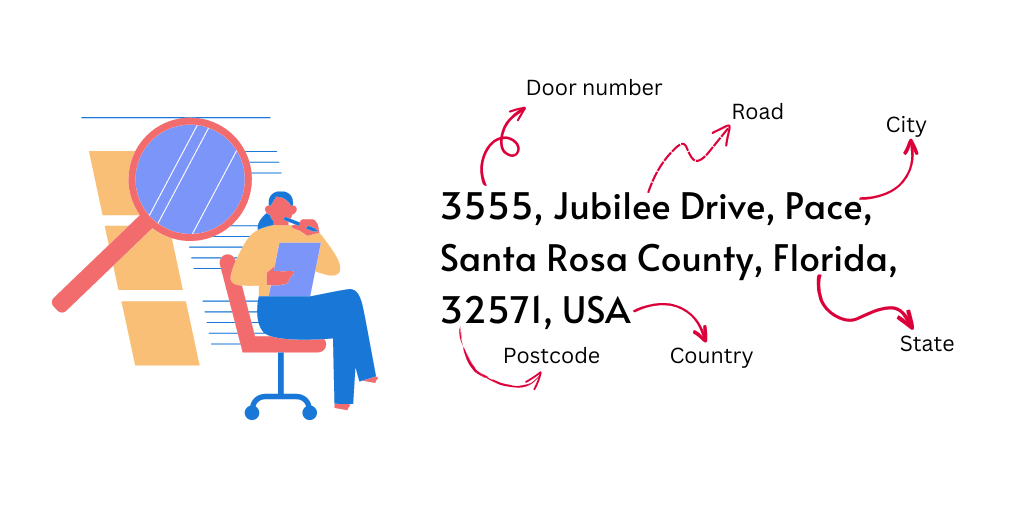
…acts as the building block for the entire location stack. It enables the conversion of GPS coordinates to real-world locations and provides context to the data being collected. If implemented correctly, this provides a stream of real time data on exact location of service works, warehouses, service centers, customer offices, job sites and more. This data is then fed into various other systems that are used to improve business operations.
Forward geocoding API
…is used to convert address or place names into latitude and longitude. This allows the software to precisely locate a human-input address on a map, often for service dispatch and routing. This is useful when a field technician needs to input addresses of job site to find directions or when the customer wants to locate service around their area. Forward geocoding can also be used to match addresses to streets, businesses, and other points of interest.
Autocomplete API
…is similar to forward geocoding with the addition function of suggestions for addresses as a user types into a search bar or form field. This significantly improves the accuracy and speed of data entry and reduces the risk of errors.

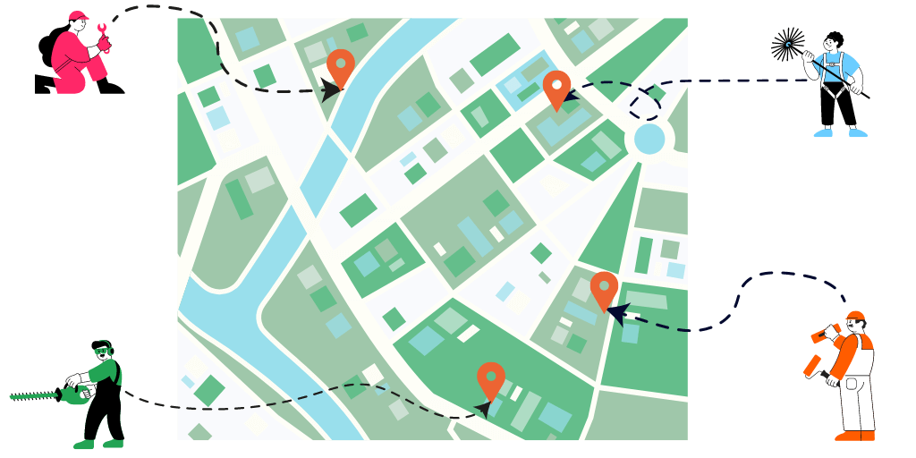
Distance matrix API
…is used to calculate distance between multiple sources and destinations. This improves efficiency by helping decide the right technician should be assigned to a given job. A plumbing company, for example, may use the API to determine what plumber should be assigned to what job given there are multiple plumbers and multiple jobs at the same time.
Route Optimization API
…uses algorithms to determine the most efficient route based factors like distance and time. If a delivery truck has to drop parcels at 15 different locations in a given area, route optimization API determines the most efficient route to take. This limits the time and fuel spent on the road, reduces costs, and delivers an efficient service to customers, while contributing to a cleaner environment by reducing emissions.
Map tiles
…are used to give personnel an overlay and visual representation of the entire service area. From job locations, service providers, vehicles, warehouses and more…all in one place. This helps get a birds-eye view of the entire business operation. This can also be used to improve customer service by giving relevant information about a customer’s or service provider’s location. Map tiles can also be used to set up virtual boundaries or geofences around specific locations, such as job sites or service areas. This can help ensure that technicians are working within designated areas.
In conclusion, Location APIs have a significant impact on the field service industry, improving efficiency and customer satisfaction. Here’s a quick recap of what each API does:
- Reverse geocoding API: converts GPS coordinates to real-world locations
- Forward geocoding API: converts address or place names into latitude and longitude
- Autocomplete API: improves accuracy and speed of data entry
- Distance matrix API: calculates distance between sources and destinations
- Route Optimization API: determines the most efficient route
- Map tiles: gives personnel an overlay and visual representation of service area
By utilizing these APIs, field service organizations are able to better manage scheduling and dispatch, technician availability, equipment management, and customer communication.
LocationIQ offers a wide range of APIs needed to power your field service business. Check us out If you’re looking for a reliable, affordable, and scalable solution.