As the world reckons with climate challenges, staying informed about the state of the environment is more important than ever. An immediate impact of climate change is Air Pollution that has become a health hazard. Both short-term and long-term exposure to air pollution leads to a wide range of diseases. From respiratory issues to immunological, neurological, and reproductive; Air pollution is the silent killer.
There is a ton of research and open data from multiple sources on air quality and other factors that contribute to air pollution but this isn’t easy-to-digest information. This prevents important conversations around climate changes and its immediate impact on the day to day lives. Founded in Macedonia in 2015, AirCare was built from the ground up to fill in this gap.
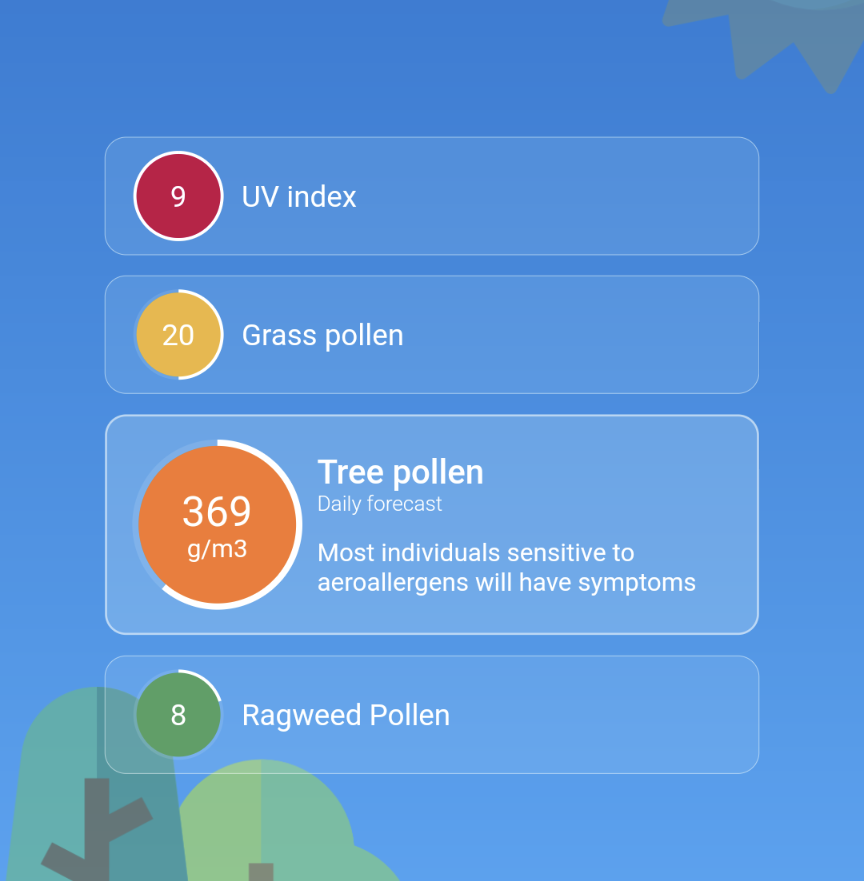
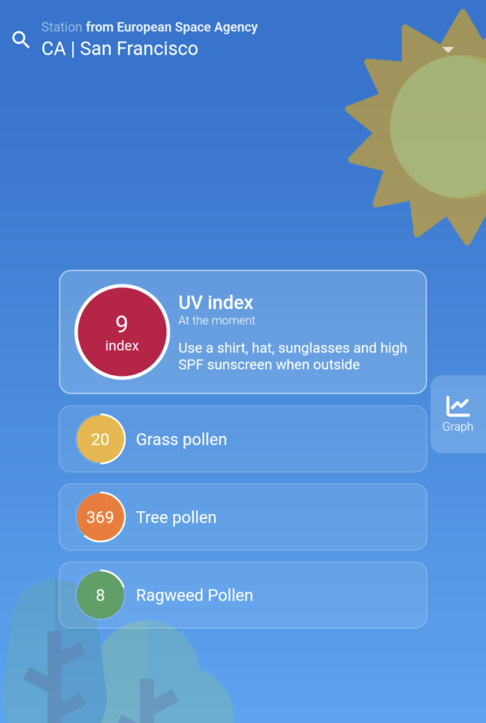
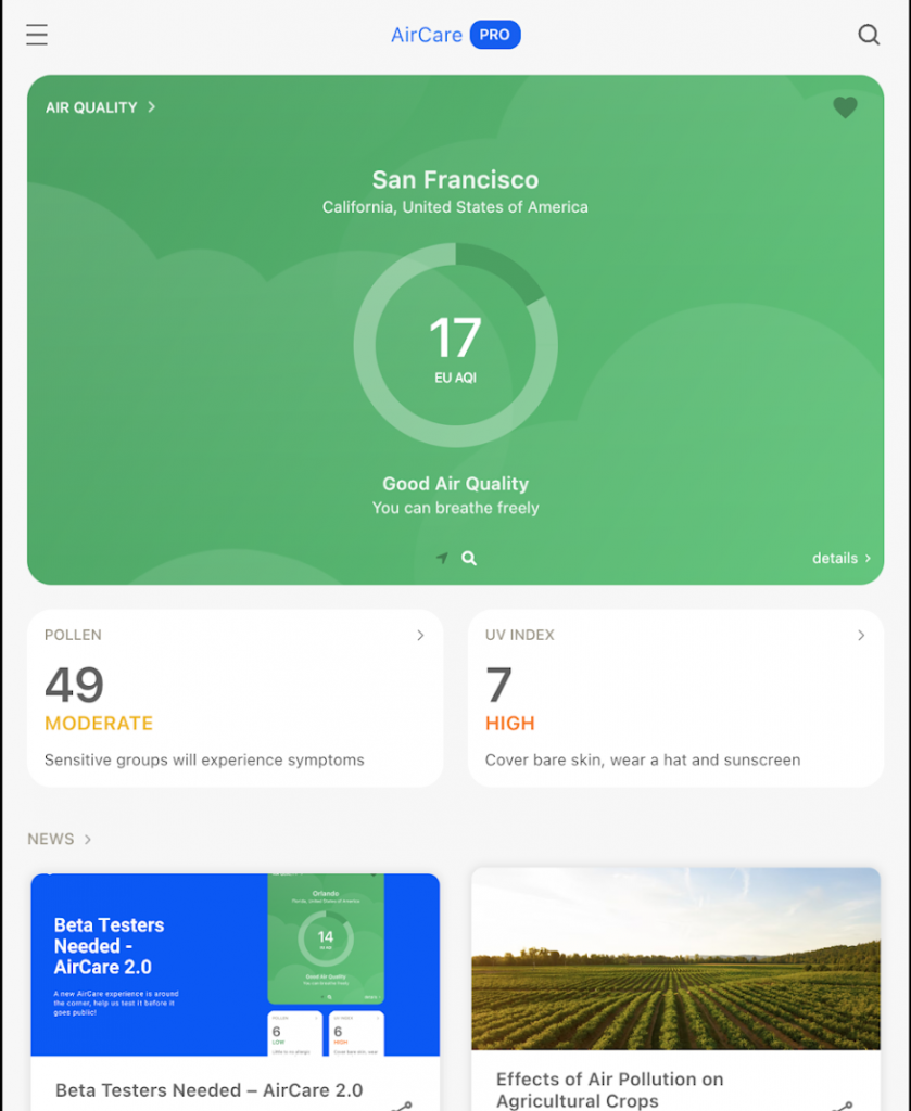
AirCare uses a combination of resources, including satellite data from the European Space Agency and government data to educate its users about air quality, and encourage them to fight for a greener future. A major challenge is to make this data accessible to the common man. This requires transforming large blocks of data to a digestible form and allowing users to easily extract insights. Tailoring information to a user’s location is an important element of this – allowing people to measure the impact of climate change on their lives
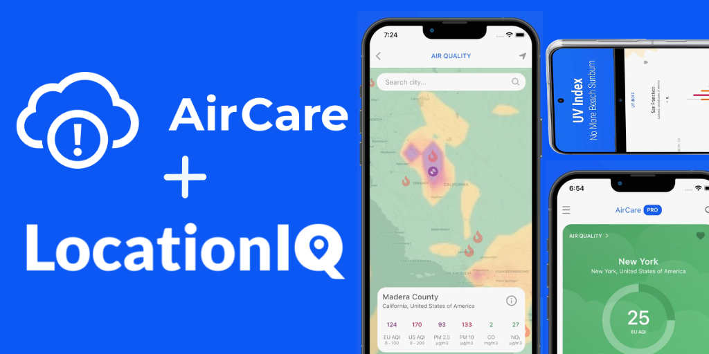
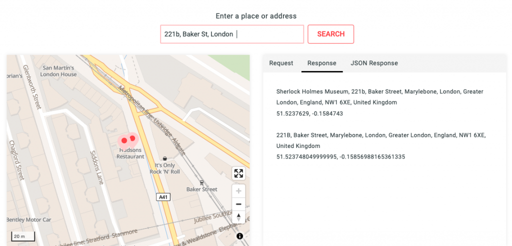
AirCare partnered with LocationIQ to make sense of the data and tailor the experience for its users. LocationIQs APIs help translate coordinates associated with air quality data to names of streets, neighborhoods, cities, counties, states and countries. On the flip side, user’s need a way to input their location in the form of an address and have AirCare provide insights. This helps break down the barrier between hard data and human language.
LocationIQ’s reverse geocoding API converts GPS coordinates to the name of the place to make data human readable. When geographical coordinates are sent to the API, it outputs the name of the actual location along with the breakdown of the address into various components. (Street, Neighborhood, City, zip code etc). The application then displays the air quality readings for that specific location.
LocationIQ’s forward geocoding API is used to allows users to look-up air quality information for other places around the world. When a user inputs a location’s name, the name is sent to LocationIQ, which analyzes the input and translates it to geographical coordinates.
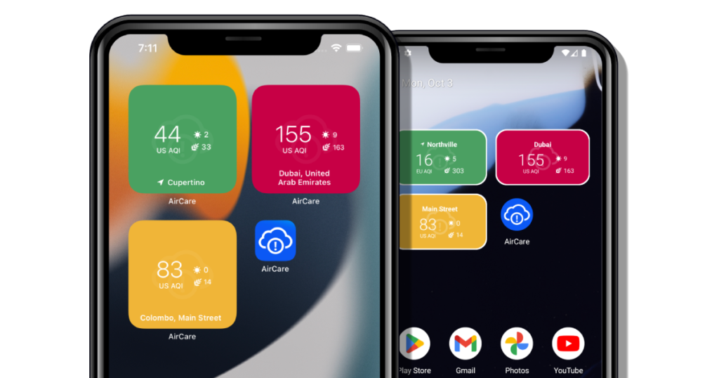
This allows the application to understand the area the user is looking for and return air quality readings for that location. LocationIQ’s autocomplete API takes this one step further by predicting results as the user types the name. This improves user experience by eliminating friction and cutting down the time it takes to find the desired place.
LocationIQ’s geo-APIs are leveraged to translate data to human-readable form, and to improve user experience. This allows AirCare to share better insights with users. The aim has always been to democratize all types of atmospheric data and help start a conversation on the impact of pollution on our everyday lives.
AirCare received over 15 million App interactions last year and has won over 20 national and international awards. Aircare has quickly spread to have a global presence, as people around the world have come to realize the importance of clean air, and need for reliable data.

“We were looking for a solution that’s easy to integrate and scale. LocationIQ fit the bill perfectly.”
Wondering how location can power your solution? Reach out to us with your goals and let’s build something together!