When dealing with geographic data, you have two key options when it comes to map types: vector and raster. Both offer their own benefits and drawbacks, so how can you decide which one to use? Here is an overview of the distinctions between vector and raster maps, and what occasions they should be used for.
What are vector map tiles?
Vector maps are two-dimensional maps that use geometrical shapes such as points, lines, and polygons to represent geographical features. In contrast to traditional raster maps that are composed of small square pixels, vector maps are made up of shapes that can be used to represent different features at different scales. Vector maps may also include labels, colors, or other information besides the geometry of the objects they contain.
Benefits of choosing Vector maps
- Vector tiles offer higher resolution
- If you’ve ever tried to use a map on your phone, you know the frustration of trying to zoom in far enough to see the details you need, only to have the image become pixelated and unusable. Vector maps are made up of instructions instead of pixels, so they can be enlarged without losing resolution.
- Vector maps can be easily edited
- Vector maps are also editable so you can easily add, remove, or move features. You can change the way data is displayed on a vector map, without having to redraw the entire map. This can be incredibly useful when you want to focus on a specific area, or when you want to change the way data is displayed to better understand it.
- Vector tiles use less bandwidth
- Vector tiles are better for server-side performance because they use fewer resources. The footprint of data transferred is smaller for vector map tiles when compared against raster for the same map, meaning lesser bandwidth use and fewer bytes used.
What are Raster Map tiles?
Raster maps are digital pictures composed of tiny squares, or pixels. Each pixel holds data about a particular geographic area, like the height of a mountain or the type of vegetation. These maps are often employed for natural resource management, environmental monitoring, and planning. Navigation also utilizes raster maps – these can help us identify the nearest gas station or restaurant.
Benefits of choosing raster maps
- Raster maps offer a better user experience
- Raster map tiles are a great way to improve the performance of your web mapping applications. Raster map tiles are less demanding on the end users’ hardware – you can improve the speed and responsiveness of your web maps, and make them more user-friendly.
- Raster maps are easier to use
- Raster map tiles are easier to use than vector maps, because they are already in the correct format for use in mapping platforms. This means that you don’t have to worry about converting your data into the right format, or about losing any information in the process.
- Raster maps have better integration
- Raster maps do a much better job of integrating with multiple data sources and displaying over web/mobile any lesser-known platforms. That’s because raster map tiles are just images – they don’t have any computational component in them.
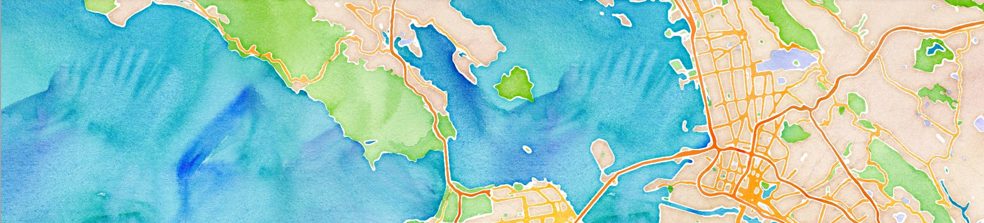
Now that we know the differences, let’s do a quick comparison of how vector vs raster maps look like at various zoom levels. We’ll compare maps at 3 different zoom levels.
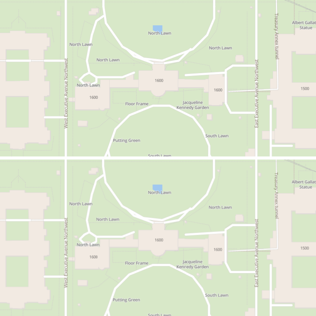
1. Let’s start off at a higher zoom level as this is usually how you’ll usually see maps implemented. Vector tiles are on the top and raster on the bottom.
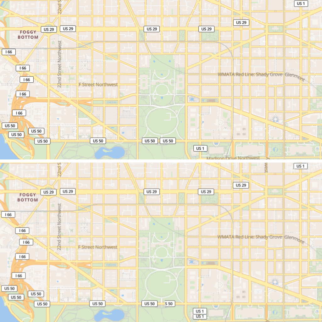
2. Let’s zoom in a bit further to see how things change
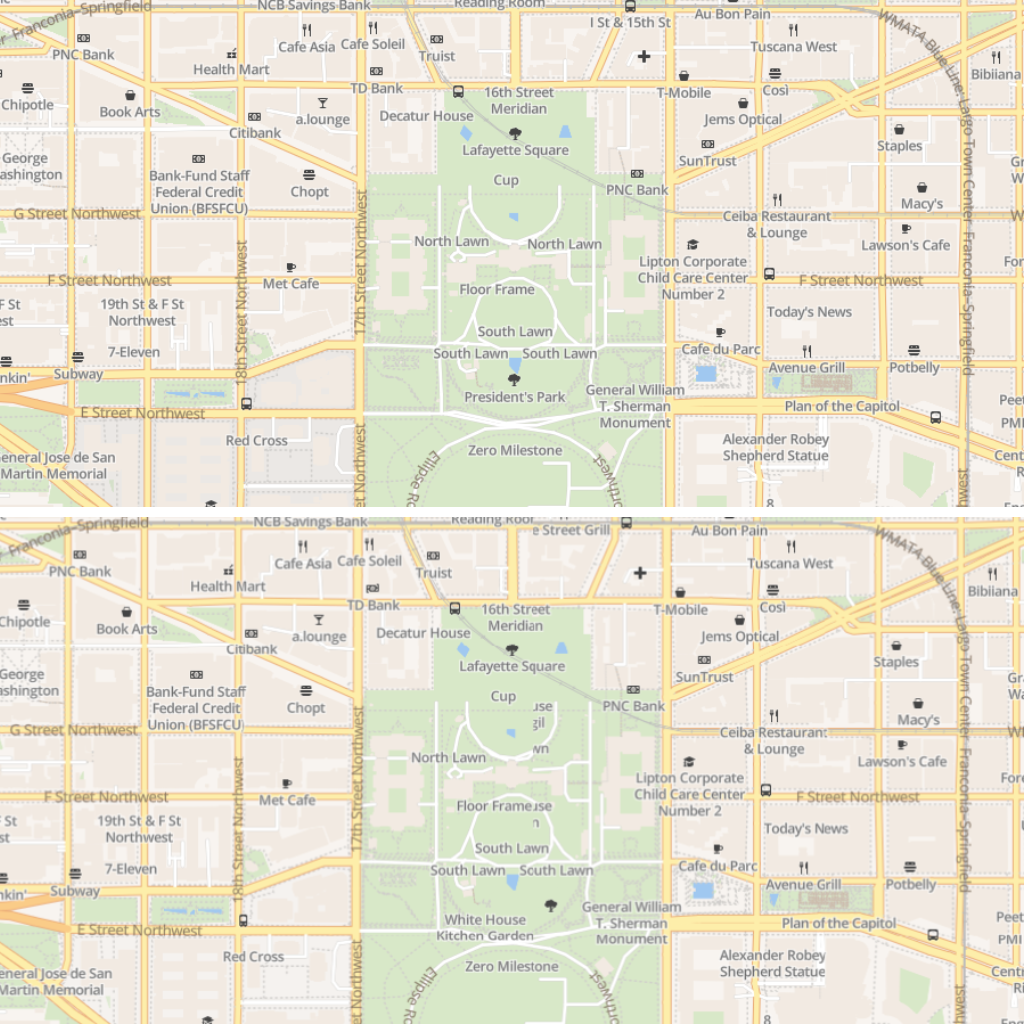
3. A little more zoom so we’re able to contrast the two
If you want to test his by yourself, you can find our sandbox of our raster maps here. A sandbox with vector maps is available here. If you’re ready to get started, check out our Maps documentation here.
So, what’s the best map tile?
Well, just like ice cream flavours, there’s no single answer to the question of which type of map – vector or raster – is the best for your project. It’s all about the specifics of what you need. If you’re looking for a highly detailed, precise map, then a vector one is probably the way to go. But if you need something less detailed and more pliable, you should look at a raster map.
If you’re unsure, reach out to us with a description of your solution and we’ll figure it out together.